One
Tree Hill and its surroundings: a (very) local history
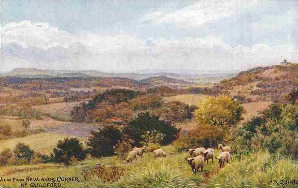
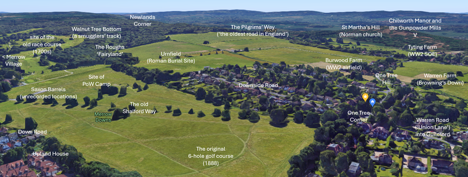
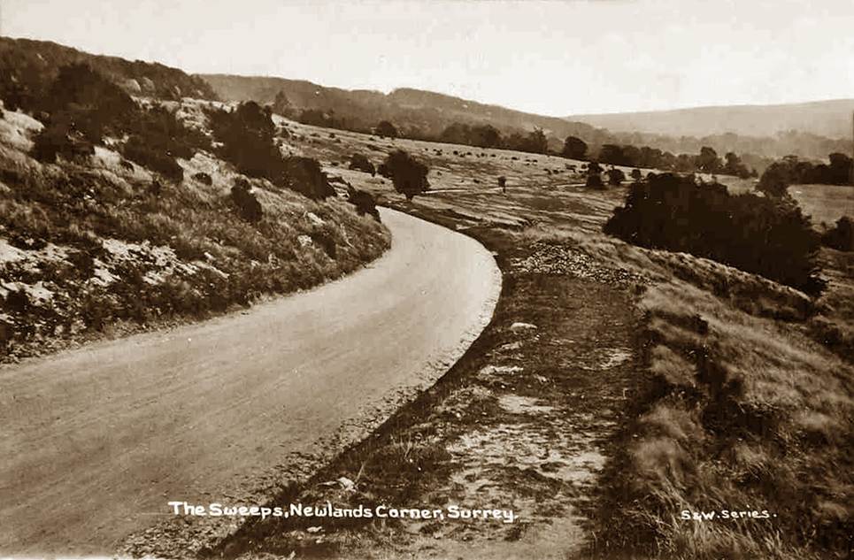
One Tree Hill Road is a beckoning gateway to the Surrey Hills and the North Downs. Surrounded by ‘Area of Outstanding Natural Beauty’ (AONB), it leads towards the 900 year old St Martha’s-on-the-Hill (Domesday), the only church on the ancient Pilgrims’ Way between Canterbury and Winchester (and the start of the Downs Link path to the South Downs), to Pewley Down, the Chantry Woods, and to the centuries renowned unspoilt views at Newlands Corner, described in an early Victorian text as ‘far-famed, from whence the extensive view is one of the most charming that the eye could rest upon, every variety and characteristic of an English landscape being here represented’. Today, few would disagree.
From One Tree Corner, a path up to Newlands Corner passes through the Roughs. The land was once much more open with views across 8 counties. With fewer sheep farmed in late Victorian times (foreign competition), exacerbated by an outbreak of myxomatosis depleting the rabbit population in the mid-20th Century, scrub and trees have taken a hold on the Downs.
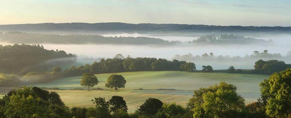
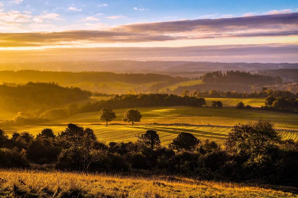
Newlands Corner – not much changes
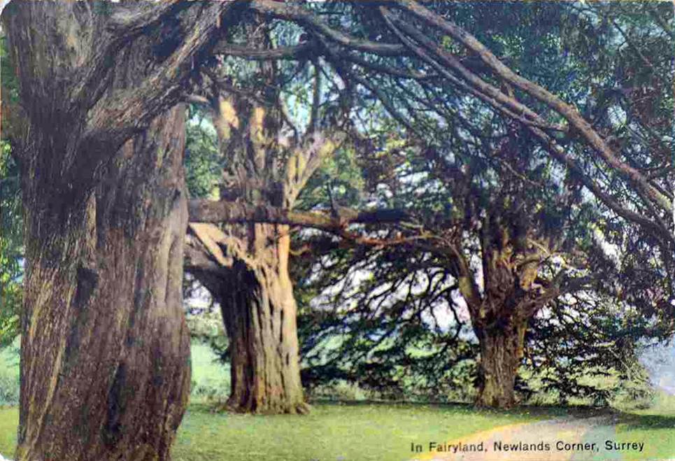
The Roughs were commonly known as ‘Fairyland’ until the 1930s – the ancient yew trees still stand among the more recent woods, some estimated at more than 2,000 years old (several with more than 20 foot girth). It has been suggested that the groves of yews may have been part of ancient pre-Christian graves. The Druids were said by Ceasar to have preached a doctrine of immortality of the soul and regarded the yew as a symbol of that. The English yew was often used for spear shafts, but too brittle for bows, with yew from France or Spain imported instead.
Though the Pilgrim’s Way is in the Domesday Book, flint spearheads and arrow tips suggest it was in use for thousands of years. Hilaire Belloc described the route over the Downs to St Martha’s as part of the oldest road in England (1911).
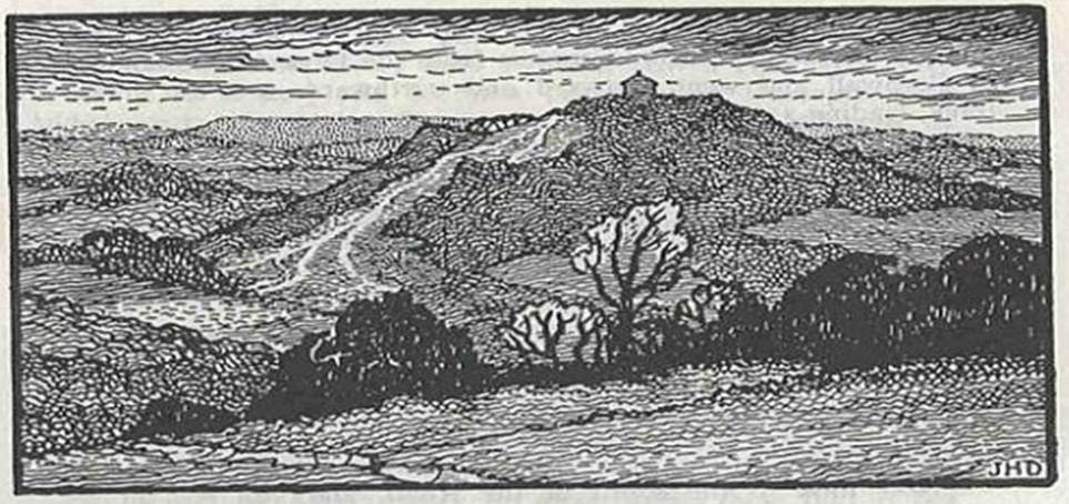
The Pilgrims’ Way passing over St
Martha’s – view from the Downs by Newlands Corner
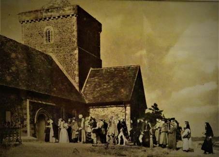
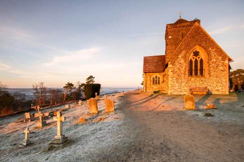
St Martha’s (rebuilt from ruin by
the Victorians) – and today.
Legend has it that the Phoenicians used the Pilgrim’s Way, the ancient trackway along the ridge of the North Downs, to bring tin on the backs of mules from the mines of Cornwall. Just below One Tree Corner, there was likely an old farmhouse with extensive cellars, the destination of many valuables which were intercepted on the Pilgrims’ Way and brought down towards Walnut Tree Bottom through the Roughs: a well-used path today, but once a smugglers’ track.
In his ‘Just So Stories’ (1902), Rudyard Kipling wrote of this ancient passage in his poem ‘Merrow Down’, abridged here:
There runs a road by Merrow
Down -
A grassy track today it is -
An hour out of Guildford Town,
Above the river Wey it is.
Here, when they heard the
horse-bells ring
The ancient Britons dressed and rode,
To watch the dark Phoenicians bring
Their goods along the Western Road.
[more verses]
Of all the Tribe of Tegumai
Who cut that figure, none remain, -
On Merrow Down the cuckoos cry -
The silence and the sun remain.
And in the final verse, of his daughter who died aged 7 from pneumonia in 1899:
For far – oh, very far behind,
So far she cannot call to him,
Comes Tegumai alone to find
The daughter that was all to him!
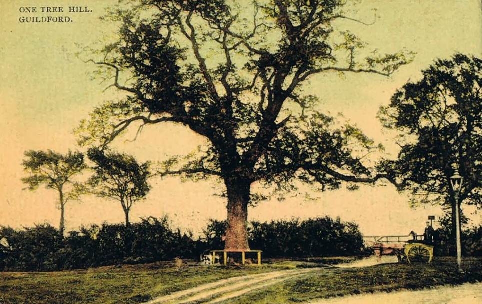
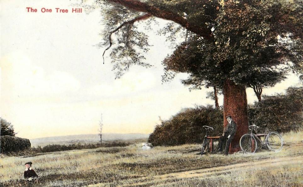
One Tree Corner, 1909
(One Tree Hill Road, bottom right. The cart track is what likely became
Downside Road)
The original ‘One Tree’ was described as a magnificent elm, standing on the triangle at the end of the road. It was cut down in 1972 (likely a victim of Dutch Elm disease), and the copper beech now at this corner was planted to replace it.
Past owners of the land have included the Crown under Edward the Confessor, then Henry I (the Conqueror’s youngest son), the Knights Templar, Benedictines, then chartered from Henry VIII to Sir Henry Weston of Sutton Place (1531), restored to the Order of the Knights of St John in England by Queen Mary (1555), reverting to the Crown (the priory dissolved under Elizabeth I, 1558), then back to the Weston family the next year. The Westons, though still land owners around Albury, sold this land along with Clandon Park to Sir Richard Onslow. It remained Earl of Onslow land until the 20th Century.
One Tree Hill Road is still a country road leading to Halfpenny Lane and St Martha’s and, in the valley below, to Chilworth Manor (once a monastery, now a beautiful house and vineyard, with plenty of its own special history too long for this piece).
 Just
past Chilworth Manor are the gunpowder mills in the Tillingbourne
valley. Guy Fawkes took at least some barrels from this mill (mixed with
supplies from other mills to hedge against duff barrels). The mills continued to
operate for centuries, even supplying munitions to the front line during the
First World War.
Just
past Chilworth Manor are the gunpowder mills in the Tillingbourne
valley. Guy Fawkes took at least some barrels from this mill (mixed with
supplies from other mills to hedge against duff barrels). The mills continued to
operate for centuries, even supplying munitions to the front line during the
First World War.
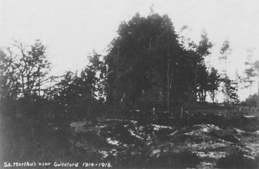
Given the importance of the gunpowder mills during the First World War, St Martha’s Church on the hill above posed a risk as a landmark for enemy Zeppelins, so fir trees were leant against the Church to camouflage it.
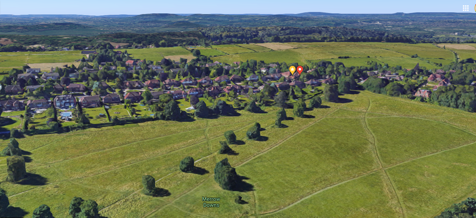
The avenue of trees leading up to One Tree Corner (distinct in satellite images) is part of the ancient Shalford Way from Merrow Village, across the Downs and over to Shalford. Cattle and sheep would also be driven to market along this route, breaking off the Shalford Way along Warren Road (then known as Union Lane) to continue ‘up’ to Guildford for the market on North Street. Now a path through long grass and trees, it was actually open to vehicles until 1985, from One Tree Corner to the Golf Club. (In fact, a road was proposed in the 1970s linking Epsom Road to Chilworth Village, cutting across the west side of Merrow Down to join One Tree Hill – the proposal met sufficient local opposition.)
Looking South East
Looking South West
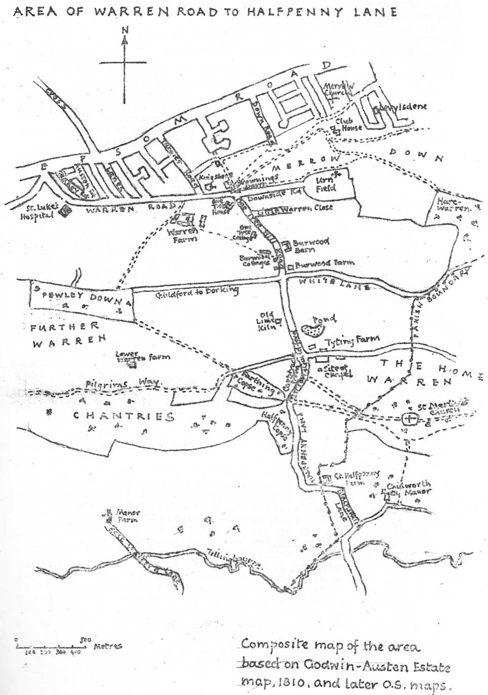
One Tree Hill Road is the east boundary of an area known as Browning’s Down (an area one and same as for Warren Farm, 170 acres). The Browning Family were at Warren Farm in the 14th Century – Gregorio Brounyng is recorded in a tax record from 1332. The family were possibly victims of the Black Death or died out with no male issue, but the family name continued to lend the area its name.
At the medieval Warren Farm, just off the footpath between One Tree Hill and Pewley Down, manorial courts of administration were held until 1615 (the motifs of a Tudor rose and fleur-de-lys are still evident in an upper room of the current Warren Farm).
Browning’s Down was appropriated as the name of the house on One Tree Corner (see right) in 1890. This was the club house for the old 6-hole golf course on Merrow Down (but not the original club house, the club being run from a house on Down Road). The course quickly expanded to 18 holes (1888) on land rented from the Earl of Onslow for one shilling per year. As the course expanded eastwards, in 1901 it abandoned the original holes and so too the club house on One Tree Corner.
Prior to golf, Merrow Down had been the setting of a 2-mile racecourse from 1701 to 1870, with annual races during Whitsun drawing crowds from far afield. The grandstand was at the end nearest to One Tree Hill. The greatest racehorse of the 18th century, ‘Eclipse’, raced here in ‘His Majesty’s 100 guineas’. He won all his 18 races, most with a walkover. Jockeys could never hold him and all they could do was to sit on his back and let him win his races in his own way. Over 90% of all modern thoroughbreds descend from his male line. The Horse & Groom in Merrow Village (down the avenue from One Tree Corner), was once named ‘The Running Horse’. After the Napoleonic Wars, racing on Merrow Down did not revive and was overtaken by Epsom and Ascot. The timber grandstand was pulled down and burnt outside Trinity Church on Guy Fawkes night.
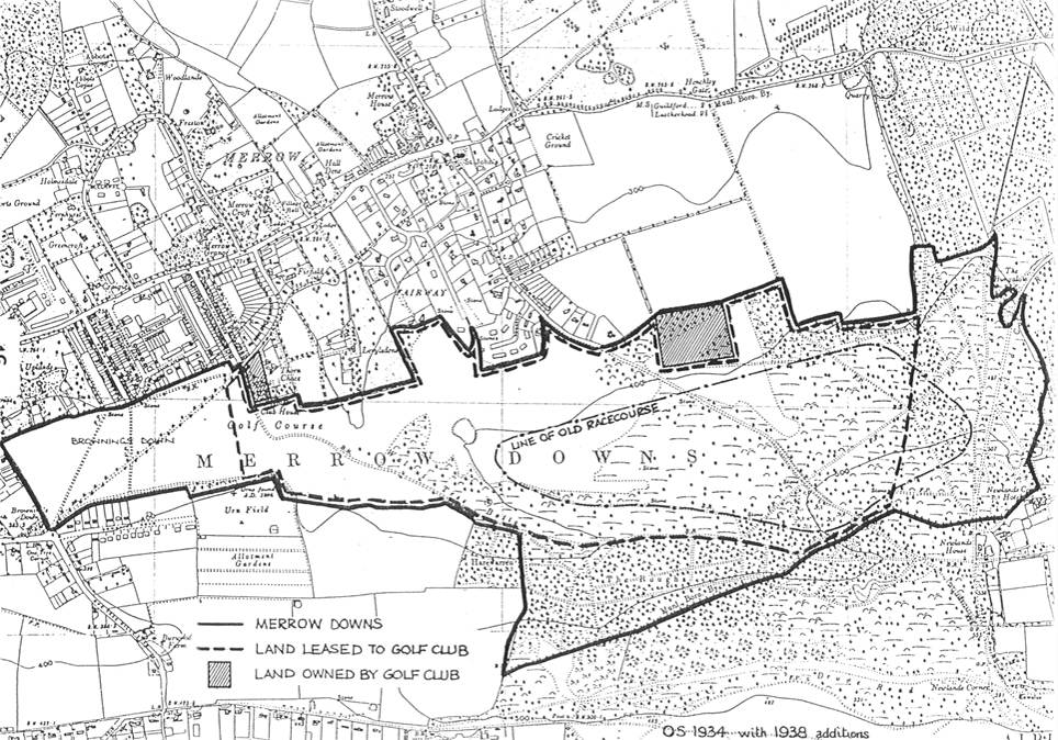
An old map showing One Tree Hill
(bottom left), and the position of the old racecourse
In 1876, Pitt Rivers (of Uplands House, a few hundred yards from One Tree Corner), excavated six Saxon barrows on Merrow Downs in a cluster on the top of the hill just south of Level’s Dean (today, ‘Levylsdene’). These included evidence of burnt body and bone and a Saxon knife blade. The position of these barrows is not now known precisely, but General Pitt Rivers’ collection of weapons, implements and archaeological discoveries is housed in the Pitt Rivers Museum at Oxford.
Older still, there is a 2,000 year old Roman column (authenticated by the British Museum) in the garden of One Tree House (on the inside of One Tree Corner opposite). In 1896, urns were discovered on a Roman burial site in what is now known as ‘Urnfield’ at the end of Downside Road (these are in the Guildford Museum at Castle Gate). There was an anti-aircraft gun stationed at the Urnfield during the Second World War (targeted by a bomb).
In wartime, the Italian Prisoner of War Camp stood on Merrow Down. In 1942, the surreal site of an enemy officer in full uniform walking out along One Tree Hill and chatting to locals was reported to the police, then in turn to the War Office, which it transpired had authorised such parole for Italian medical officers and chaplains months before, under the Geneva Convention. It was only then realised that no one had informed the Home Office to alert Chief Constables.
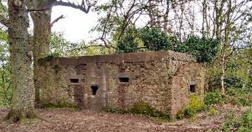 Along
the top of the North Downs, including on the lanes leading out of One Tree Hill
Road and on the Pilgrim’s Way up to St Martha’s, are several wartime defensive
‘pill boxes’. The North Downs was just a day’s march from the coast and was
deemed the last line of defence before London should Hitler have reached
British shores.
Along
the top of the North Downs, including on the lanes leading out of One Tree Hill
Road and on the Pilgrim’s Way up to St Martha’s, are several wartime defensive
‘pill boxes’. The North Downs was just a day’s march from the coast and was
deemed the last line of defence before London should Hitler have reached
British shores.
During the Second World War, the RAF established an Emergency Landing Ground used to practice forced landings in ’40 Acre Field’ at Burwood Farm at the far end of One Tree Hill Road. There were a number of crashes on this site, but with one particular heroic rescue, fortunately no fatalities.
Towards the end of the war, it was propositioned that German PoWs captured in Normandy be transferred to Merrow Camp 57. The War Office vetoed on the basis that only 1,000 yards away, in the dip below St Martha’s at the other end of One Tree Hill Road, was Tyting Farm – a Secret Intelligent Services base. It was little-known even within SOE – and with good reason: it served to hold agents who had escaped back to Britain from enemy-occupied territory but needed close interrogation if their escape stories were suspect. By 1944, this included Germans, when Tyting Farm served as a holding establishment for agents of SOE’s X (Germany and Austria) Section. SOE had identified potential agents, code-named BONZOs, from German prisoners of war, captured after the invasion of occupied Europe, who had declared themselves as anti-Nazi and willing to serve the Allied cause. They were trained for reconnaissance, intelligence gathering and railway sabotage missions, being parachuted or infiltrated through the front lines into enemy territory, often in German uniform. Such agents who succeeded in evading to neutral or Allied-occupied territory after their missions, and who were returned to Britain, were accommodated at Tyting House. (It is remotely possible the landing ground at Burwood Farm may have been used to pick up or drop off agents by aircraft as part of their training.)
Tyting Farm actually dates back to before the Domesday Book (held by ‘Elmer the Huntsman’ prior to the Conquest, ‘Tetinges’ in Domesday, ‘Titing’ in the 13th Century). It was one of several local farms still accommodated in their modern form, including Great Halfpenny, Warren, and Burwood.
A 16th Century barn stands at Little Warren Farm on One Tree Hill Road (until recently it has ‘quietly’ served as a recording studio to A-list stars!). Fifty years ago, Frances White of One Tree Cottage told that her grandfather drove his flock of sheep here from Wales, probably in late 19th Century. Warren, Lower Warren and Burwood Farms were on the Earl of Onslow’s estate in the 19th Century and worked conjointly, grazing sheep and cattle, and the ‘game of conies’ (rabbits – hence the references to Warren and the ‘Hare & Hounds’, the original name of the Horse & Groom until 1813). The Earl of Onslow’s Hare Warren is still evident just south of Keeper’s Cottage in the Roughs.
Apart from the farm buildings, the few houses along One Tree Hill Road were developed in Victorian times or in the early 20th Century, built on the Earl of Onslow’s land – on this side, orchards and market gardens, with evidence of fruit trees still apparent.
In fact, in the early 19th Century, there were no houses on this side of Guildford beyond the Union Workhouse along Warren Road (Union Lane until 1912). Downside Road is a cart track visible in the corner of the postcard image and was developed in the 1930s. In 1955, Little Warren Close was developed on dairy farmland.
Otherwise, not much has changed in five centuries!
Edition 1.0
Acknowledgements too many to list.
Insights / corrections to email@andrewflood.com please.
More maps and pictures follow
below…
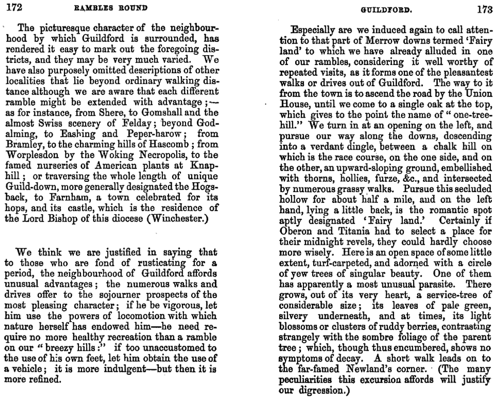
Extract from Rambles Round
Guildford, author unknown, 1857.
While the language is distinctly of
its time, what it describes is still recognisable today.
The reference to the ‘single oak’ as
the ‘One Tree’ is at odds with the more often referenced Elm. Possibly it was
mis-identified by the author.
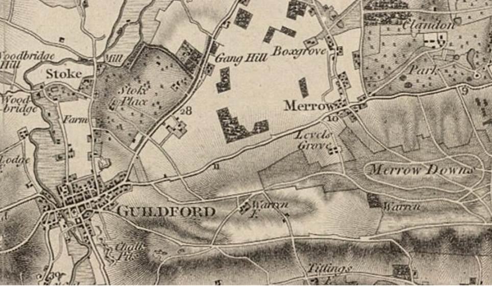
Map by Mary Butt, 1983
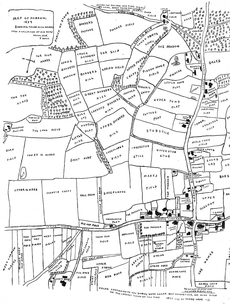
Merrow, 1839
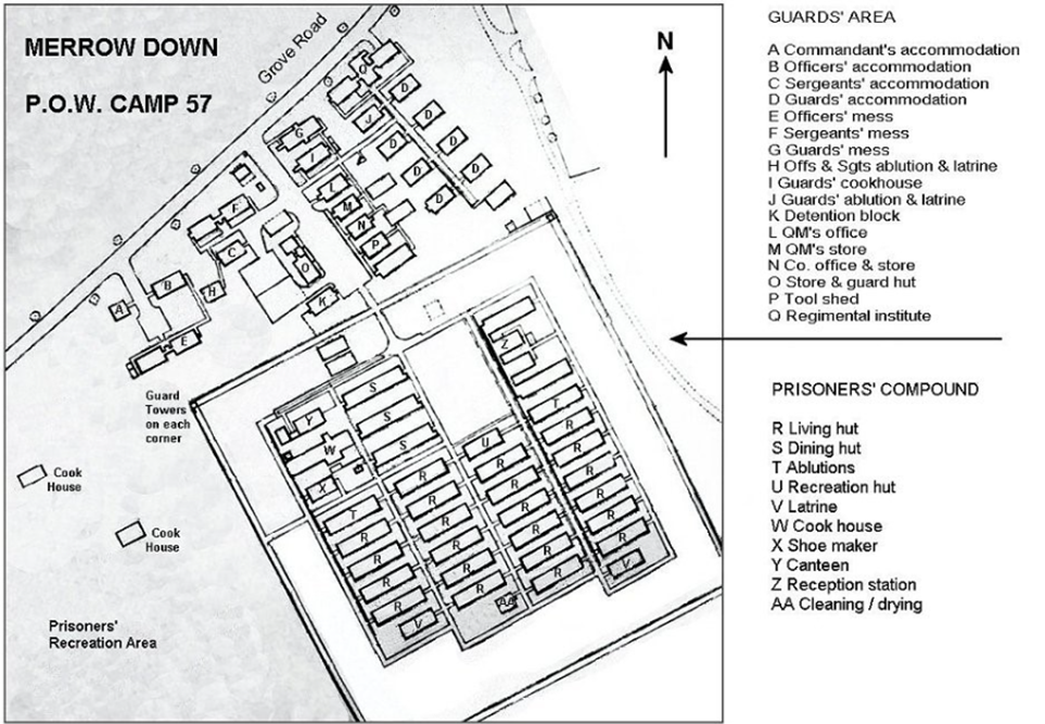
Plan of the camp – adapted from display board on Merrows
Down
Down Road,
looking up to Merrow Down Ordnance
Survey, 1961 – PoW Camp still evident
– with the PoW
Camp watchtower visible
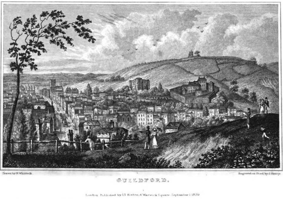
View over Guildford and up to St
Martha’s from the Mount
Excerpt from John Rocque’s
Topographical Map of the County of Surrey, 1762
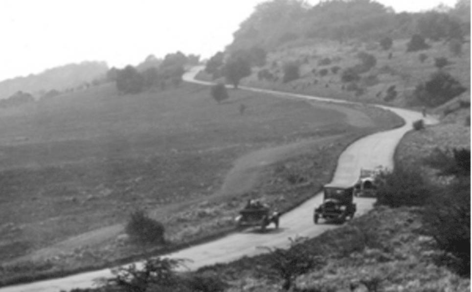
Climbing to Newlands Corner, 1927
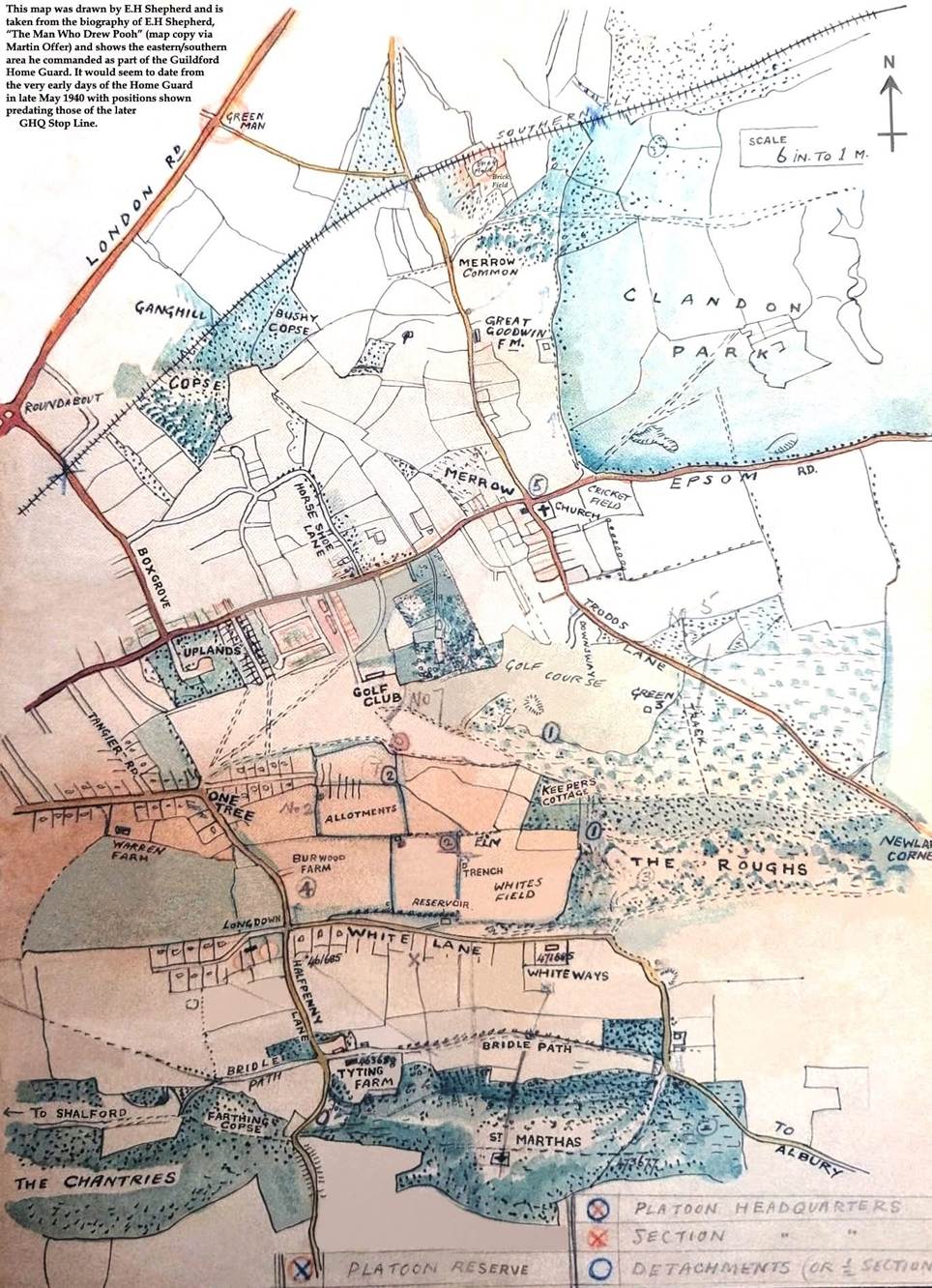
Illustrated by E.H. Shepherd (‘The Man
Who Drew Pooh’), who lived on Longdown (at the end of One Tree Hill Road).
Annotated for Home Guard purposes, 1940.